Talsim —
Simulation system for
water resources systems

Talsim represents rainfall-runoff processes, reservoirs and their operating rules within a river basin — as a continuous long-term simulation or for individual events. This page collects the documentation and the tools around Talsim.

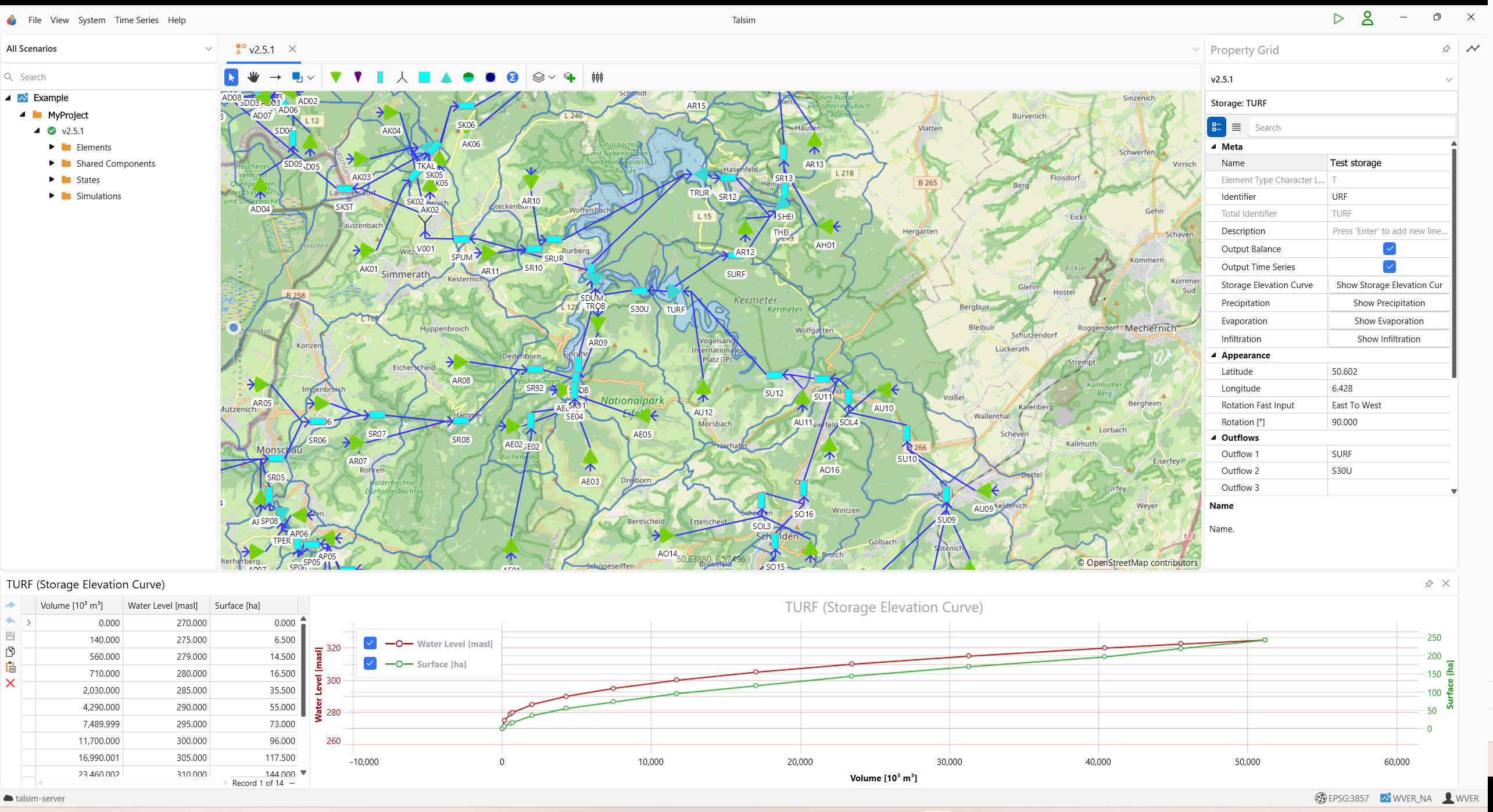
System plan of a river basin in Talsim5

Talsim tools

Talsim5 docs Documentation of the current version Manual covering system elements, operating rules, time series, database and simulation.
QTalsim QGIS plugin Prepare geodata, build and check Talsim models in QGIS.
talsimpy Python package Interface to Talsim4 data sets and Talsim5 databases: read, edit, run simulations, evaluate time series. Documentation GitHub PyPI

More tools

BlueM.Wave Time series software Displaying, analyzing and importing and exporting time series.
BlueM.Opt Optimization software Automated optimization, e.g. to calibrate Talsim models.
Delft-FEWS Real-time forecasting Open platform for real-time water intelligence. Flexible, scalable, and trusted to manage and visualise critical data. An interface between Talsim and Delft-FEWS is available.

Archive

Talsim4 wiki Archive of the previous version Talsim5 has been rebuilt; Talsim4 data sets can be migrated. The old documentation remains available.

Contact

Questions about Talsim?
SYDRO Consult GmbH Mathildenplatz 8, 64283 Darmstadt, Germany +49 6151 70798-0 talsim@sydro.de
System plan of a river basin in Talsim5