Hauptseite/en: Unterschied zwischen den Versionen
Keine Bearbeitungszusammenfassung |
Keine Bearbeitungszusammenfassung |
||
| (Eine dazwischenliegende Version von einem anderen Benutzer wird nicht angezeigt) | |||
| Zeile 1: | Zeile 1: | ||
<languages/> | <languages/> | ||
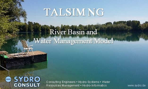
[[Datei:TALSIM-NG splashscreen.jpg|center]] | |||
<div class="mw-translate-fuzzy"> | |||
<hr/> | <hr/> | ||
Talsim-NG is a hybrid hydrologic/hydraulic river basin model. | Talsim-NG is a hybrid hydrologic/hydraulic river basin model. It is designed to capture all hydrological situations from flood to drought. The software concept is modular and scalable, meaning that a water resources system can be tailored according to the actual needs. Talsim-NG does not imply any limits for the spatial resolution of hydrological systems. The temporal resolution as simulation time step can vary from one minute to one month. Talsim-NG was applied for watersheds < 10 km² up to river basins > 3,000,000 km² (e.g. entire Nile system). | ||
</div> | |||
<div class="mw-translate-fuzzy"> | |||
The main features of Talsim-NG are: <br> | The main features of Talsim-NG are: <br> | ||
- Precipitation-Runoff modelling, including snow simulation / - Flood routing and hydraulic simulation of weirs, diversions, pipes / - Complex atmosphere-vegetation-soil module / - unlimited configuration of operation rules, reservoir operation / - conceptual groundwater model / - Nested modelling (high spatial resolution models are embedded in coarser model environments) / - Wetland modelling / - Crop water requirements and irrigation / - Watertemperature and water quality / - Time series manager / - Project and Scenario manager / - Client-Server Architecture. | - Precipitation-Runoff modelling, including snow simulation / - Flood routing and hydraulic simulation of weirs, diversions, pipes / - Complex atmosphere-vegetation-soil module / - unlimited configuration of operation rules, reservoir operation / - conceptual groundwater model / - Nested modelling (high spatial resolution models are embedded in coarser model environments) / - Wetland modelling / - Crop water requirements and irrigation / - Watertemperature and water quality / - Time series manager / - Project and Scenario manager / - Client-Server Architecture. | ||
</div> | |||
This Wiki contains the official documentation of Talsim-NG. | This Wiki contains the official documentation of Talsim-NG. | ||
<div class="mw-translate-fuzzy"> | |||
<div class="info">This Wiki is constantly being maintained and expanded. Individual sections are still under construction.</div> | <div class="info">This Wiki is constantly being maintained and expanded. Individual sections are still under construction.</div> | ||
</div> | |||
__TOC__ | __TOC__ | ||
<span id="Einführung"></span> | |||
==Introduction== | ==Introduction== | ||
| Zeile 24: | Zeile 32: | ||
*[[Special:MyLanguage/Video Tutorials|Video tutorials]] | *[[Special:MyLanguage/Video Tutorials|Video tutorials]] | ||
<span id="Theoretische_Grundlagen"></span> | |||
==Theoretical basics== | ==Theoretical basics== | ||
| Zeile 33: | Zeile 42: | ||
<span id="Modellerstellung_und_Anwendung"></span> | |||
==Model setup and usage== | ==Model setup and usage== | ||
| Zeile 46: | Zeile 56: | ||
<span id="Grafische_Benutzeroberfläche"></span> | |||
==Graphical user interface== | ==Graphical user interface== | ||
| Zeile 59: | Zeile 70: | ||
<span id="Programmstruktur"></span> | |||
==Software architecture== | ==Software architecture== | ||
| Zeile 72: | Zeile 84: | ||
<span id="Anhang"></span> | |||
==Miscellaneous== | ==Miscellaneous== | ||
Version vom 26. Januar 2024, 13:08 Uhr
Talsim-NG is a hybrid hydrologic/hydraulic river basin model. It is designed to capture all hydrological situations from flood to drought. The software concept is modular and scalable, meaning that a water resources system can be tailored according to the actual needs. Talsim-NG does not imply any limits for the spatial resolution of hydrological systems. The temporal resolution as simulation time step can vary from one minute to one month. Talsim-NG was applied for watersheds < 10 km² up to river basins > 3,000,000 km² (e.g. entire Nile system).
The main features of Talsim-NG are:
- Precipitation-Runoff modelling, including snow simulation / - Flood routing and hydraulic simulation of weirs, diversions, pipes / - Complex atmosphere-vegetation-soil module / - unlimited configuration of operation rules, reservoir operation / - conceptual groundwater model / - Nested modelling (high spatial resolution models are embedded in coarser model environments) / - Wetland modelling / - Crop water requirements and irrigation / - Watertemperature and water quality / - Time series manager / - Project and Scenario manager / - Client-Server Architecture.
This Wiki contains the official documentation of Talsim-NG.
Introduction
- Talsim-NG brochure (PDF)
- Possible applications of Talsim-NG
- Introductory tutorial (PDF)
- Operation Rules in Talsim NG (PDF)
- Understanding the Calculation of Time Steps (PDF)
- Video tutorials
Theoretical basics
The following chapter contains detailed information about the theoretical basics of Talsim:
Model setup and usage
The most important steps to setup and use a Talsim-NG river basin model are explained in the following chapters:
- Steps for setting up a model
- Simulation
- Parameter estimation and calibration
- Optimization of operating plans
- Working with TaskSrv
- Working with SydroTaskMgr
- Working with SydroCmd
- Operational use of Talsim-NG
Graphical user interface
- Login and start window
- Talsim-NG main window
- Project manager
- Time series management
- Individual model component windows
- Control clusters
- Objective functions
- Flood wave statistics
- Short-term forecasts
Software architecture
- Server/client concept
- Software components
- Directory structure
- Database structure
- Creating a customer
- Creating a user
- Interfaces: import/export
- Scripting languages
